
Alliance ZIP Code Coverage
Research verified one postal ZIP for Alliance: 44601. The verified USPS evidence identifies the Alliance Post Office and an Alliance mailing-city association. It does not support adding a second ZIP, a post-office-box-only ZIP, a unique-institution ZIP, a ZIP split, or a local ZIP population figure. Keeping the ZIP code directory to that documented scope is more useful than filling the table with codes taken from commercial maps or unverified address lists.
| ZIP code | Areas covered | Post office | Notes |
|---|---|---|---|
| 44601 | Alliance mailing city, as supported by USPS | Alliance Post Office, 36 S. Arch Ave. | Only officially verified Alliance ZIP in the research. Confirm each delivery address with USPS; a ZIP does not define city or county limits. |
That single-row table is intentional. A ZIP code is a Postal Service routing geography, not a municipal boundary, ward, tax district, school district, or land-record jurisdiction. The Alliance ZIP code directory stays limited to that verified postal fact. A parcel and its county remain the deciding keys for a deed, tax record, court route, or election office. Treat an apparent Alliance ZIP result as the first location check, not the final classification.
Confirm Alliance Postal Delivery
USPS identifies the Alliance Post Office at 36 S. Arch Ave., Alliance, OH 44601-9998, with telephone 330-821-3560. Its 2025 L007 label list also identifies 44601 as Alliance, OH. Use the Postal Service’s individual address and ZIP tools when the delivery assignment itself needs confirmation. That is the appropriate source for postal geography, even if a different public record uses a county, city, or historic place-name label.
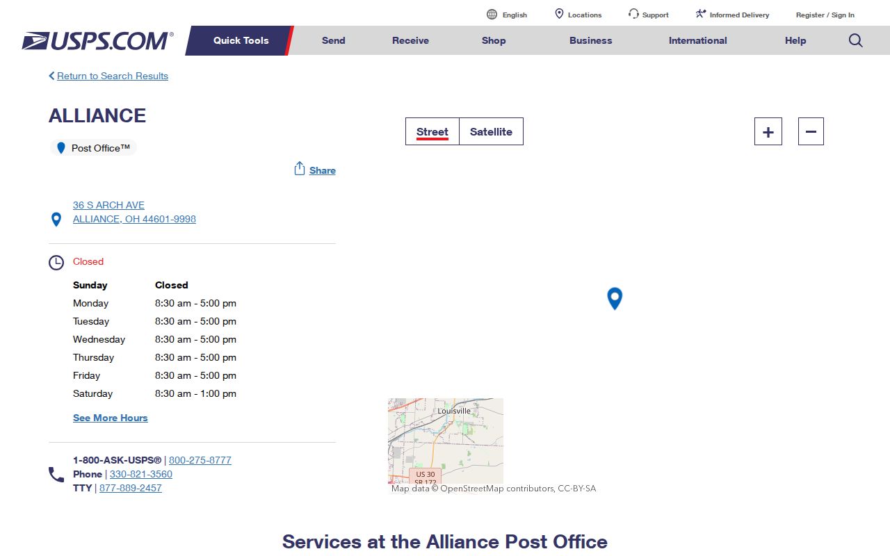
The USPS location record supports the documented 44601 entry, while address-specific verification remains necessary for a particular delivery point.
A ZIP+4 is a more precise Postal Service delivery segment attached to a five-digit ZIP. It can improve mail routing but does not replace a parcel number, recorded legal description, or city boundary check. An address may use a valid ZIP and still require a different county custodian than a nearby address.
Note: Postal verification answers a delivery question, while a county parcel record answers the separate question of where a land record is kept.
Search the Alliance ZIP Code Directory
ZIP-based searching in Alliance is a way to constrain official property results, not a way to create a resident roll. Stark Real Estate Search includes ZIP Code as a Basic Search field. Its result set concerns parcels, owners, addresses, values, sales, and tax information. A property owner or tax-mailing result cannot identify all people living at the property. Ohio Voter Lookup does not provide a ZIP search. It requires a person’s first name, last name, and county, while the state’s voter-data portal is organized by date and county request rather than a ZIP-wide resident output.
- Verify the delivery ZIP for the exact address through USPS, and retain any directional prefix in the street name.
- For a Stark-side parcel, enter 44601 in Stark Real Estate Search with an address number, street, owner, or other known field to narrow the property results.
- Open the property card and capture the PIN, site address, legal description, owner field, and mailing field. Read those fields as property and correspondence facts, not a household roster.
- Use the city map and the correct county parcel route before seeking a deed, court file, or voter record. Once a ZIP is narrowed to a named street, the Alliance street directory has the fuller address-by-address record trail.
Stark’s Basic Search can handle a partial street, and its help recommends omitting a suffix for an initial broad search. Large result sets can be capped at 500 displayed results, so add a house number, direction, or another known field instead of assuming the first screen is complete. Search scope matters more than the number of results.
Stark Postal Property Field
The Stark property portal documents its ZIP control as one part of a broader parcel search. It also has Basic, Advanced, GIS/Map, and Septic & Well modes. Use it with a second field where possible. A ZIP-only query may return a broad property set and should never be read as a list of residents. The portal is free and reference-only; original recorded documents remain the source for a legal conclusion about an instrument.
| Field label | Type | Required | Use in a ZIP query |
|---|---|---|---|
| ZIP Code | Text | No | Constrains the property search to a postal ZIP value. |
| Address # | Text | No | Adds a specific street number. |
| Street | Text | No | Accepts a partial street; the help documents an asterisk wildcard. |
| Suffix and Dir | Selector fields | No | Keep direction separate when it distinguishes the street. |
| Owner or Parcel ID | Text | No | Useful for narrowing a known parcel or ownership lead. |
Note: The ZIP field narrows property records, but neither the portal nor a postal ZIP proves municipal residence or county jurisdiction.
Alliance ZIP Code County Check
Alliance is principally in Stark County, yet part of its municipal footprint reaches Mahoning County. The same Alliance mailing name and 44601 ZIP cannot tell a researcher which county maintains the correct parcel, deed, court, or election record. First orient the address with the city map. Then use the county Auditor or GIS identified by the parcel’s location. For a Mahoning-side property, the Mahoning County Auditor accepts parcel, owner, and address searching, while Mahoning GIS supplies the alternate-county map route.
Mahoning guidance distinguishes Deeded Owner Address, the address in the last recorded document, from Tax Payer Address, the correspondence address. Those are not interchangeable with the property situs or a person’s physical residence. The distinction is especially important when a ZIP-led property search returns an owner whose mail goes elsewhere.
Note: Verify the parcel county before ordering a deed, tax record, court file, marriage record, or election record for an Alliance address.
Alliance Parcel Address Keys
Three address terms solve different parts of an Alliance ZIP code search. The situs is the physical property location used by maps and property rolls. A mailing or taxpayer address is a correspondence position and may be a post office box, business, agent, or another home. A legal description is the lot, block, subdivision, or metes-and-bounds identity used to match a property in deeds, even when a street label has changed. Keep all three rather than replacing one with another.
- ZIP and ZIP+4
- A five-digit Postal Service routing code and its more specific delivery extension. Neither establishes a land boundary.
- PO-box ZIP
- A ZIP used for post office box mail. No such Alliance-specific ZIP was verified in the research.
- Unique ZIP
- A ZIP assigned to a single organization or delivery destination. No Alliance-specific example was verified.
- Carrier route
- A Postal Service delivery grouping. It is not a census of people at the addresses on the route.
Alliance ZIP History Numbers
Historic address work needs more than a ZIP. The 1897–98 Alliance directory preserves directional forms including S Union, E Market, W Main, S Seneca, E Columbia, and W Ely. Leaving out an E, W, N, or S can point to a different street or cause an optical-character-recognition miss in a digitized volume. Preserve the original directional prefix when moving from an older directory to a current map or a property search.
For older street context, the City archive contains ordinances from 1854 through 1933 with visible gaps, and a City/Rodman effort digitized minutes and ordinances from 1854 through 1924. Sanborn maps cover Alliance from 1867 through 1970. These sources can date a street or building context, but the research did not identify an authoritative general street-renumbering or grid-origin year. Ask the map or reference staff about a particular address rather than assuming a universal conversion rule.
Note: Preserve an old directional prefix and place name until a map, ordinance, or legal description supports the historical address match.
Alliance Postal City Limits
A ZIP boundary and an Alliance city limit answer different questions. USPS confirms postal delivery geography. The City’s Maps & Resources hub provides a city GIS link, color street map, ward and precinct maps, zoning map, centerline materials, and coordinate documentation. The City GIS viewer can orient a street or address to city mapping. The appropriate county Auditor identifies the parcel and county record. Use all three roles in sequence.
Boundary check. An Alliance or 44601 mailing label does not choose the Stark Recorder, Stark Board of Elections, or any other custodian by itself. Confirm the physical parcel and county first.
The City mapping and engineering contact listed at the map hub is 504 E. Main St., 330-823-5122, weekdays 8–4. The research does not state that this office assigns all addresses, so send a historic street, centerline, or map question there without claiming a broader authority. For a record request, identify the exact address, date range, and record series under the Ohio Public Records Act.
Alliance ZIP Code Research Boundaries
The verified ZIP evidence supports 44601 and an individual USPS address check. It does not support a second Alliance-serving ZIP, ZIP-level population or voter totals, a ZIP realignment date, an authoritative postal-overlay map, or a ZIP filter in City GIS or county GIS. The Ohio Department of Rehabilitation and Correction search has a ZIP field only for its stated supervision and Violators at Large scope, so it is not a geographic resident roll. Keeping those limits visible avoids turning postal data into a claim it cannot support.
For a specific Alliance address, the most reliable sequence remains delivery ZIP, city geography, county parcel, legal description, and the named custodian’s record. That sequence also leaves room for older place names and directional streets when an archive or historical directory is involved.