
Alliance Neighbors by Block Source
A useful block search has a narrow purpose: understand the parcels immediately around one address and the public record tied to those parcels. Stark GIS and the Auditor's property record form the primary route for most Alliance addresses. The city extends into Mahoning County, so an Alliance mailing address does not by itself choose the right map or Auditor. Historic directories and public community organizations add dated context, but neither turns the block into a current resident list.
| Source | What It Shows About a Block | Access |
|---|---|---|
| Stark GIS and Auditor | Parcel adjacency, parcel number, public owner and tax-map fields. | Public map and property card; not a people census. |
| Mahoning GIS and Auditor | The comparable parcel route for an Alliance parcel in Mahoning County. | Use only after confirming the county; map is not a survey. |
| Stark Recorder | Adjoining-parcel deed and legal-description context. | Party and record chain, not current occupancy. |
| City directories and Review | Published occupants or community context at a stated historic date. | Historical, date-limited source. |
| Public community contacts | Public history or association contact routes. | No verified member directory or resident roster. |
The parcel record may show a current owner, a site address, and a mailing or billing address. That supports a property question. It does not identify renters, relatives, or other household members. For a question that reaches beyond the nearby block to a full named street, use the separate Alliance street directory workflow instead of stretching a parcel map beyond its purpose.
Start with Alliance Parcel Records
Most Alliance parcels begin at Stark Real Estate Search. Its Basic Search accepts a parcel ID, owner, address number, street, suffix, direction, city, and ZIP Code. The published help advises leaving off a suffix for a broad first search, using a partial street when needed, and adding a direction or ZIP to narrow a large return. A result set can display only the first 500 matches, so a broad street result is not the same as a complete block record.
Open the target property card and preserve the PIN, site address, legal description, and access date. The Sales, Profile, Maps, and related property panels provide a lead into the surrounding parcel work. In the block map, Parcel and Roads & Addresses layers help connect the site to its visible adjacent parcels. A legal description is the record identity that can survive changes in a street number or subdivision description.
- Parcel
- A defined piece of land represented in the county's tax and map system.
- Situs address
- The physical location of the property, used to place it on a map.
- Tax mailing address
- The contact address for tax correspondence, which can differ from the parcel location.
- Legal description
- The lot, block, subdivision, or metes-and-bounds wording used to match land records.
Map the Alliance Block Parcel by Parcel
The next step is spatial, not person-first. Stark County GIS offers Basic and Advanced Parcel Viewers. The documented viewer controls include Search, Query, Select, Measure, Draw, Layer List, Buffer Search, Record Navigator, and print tools. Turn on the parcel and road layers, navigate to the target, then inspect the few surrounding geometries. A small block approach also avoids confusing a broad citywide map return with the immediate area.
- Search or pan to the target address and select its parcel in the map viewer.
- Record the PIN and legal description, then use Parcel and Roads & Addresses layers to identify the touching or nearby parcels.
- Use Select or Buffer Search for a limited set of adjacent features, then open each result through Record Navigator or the property search.
- Label the result as parcels and public owners shown on the current tax map, with the date accessed.
- Use deed records only when a legal-description question needs an adjoining-property context.
Stark's parcel service has a 2,000-feature query limit. That is another reason to stay with a handful of lots around one address. Map boundaries are informative depictions, not a land survey, and a visible block can cross a zoning, flood, neighborhood, or other map layer boundary.
Read Alliance Parcel Records Carefully
Adjacent property cards distinguish ownership and correspondence fields from physical occupancy. Stark's public parcel data can include PIN, tax year, site address, owner, owner address, mailing or billing address, legal description, owner-occupancy credit, homestead exemption, values, most recent sale, prior owner, and tax totals. A mailing address may be outside Alliance. An owner-occupancy credit is at most a dated, limited clue. Neither proves who is living at the site now.
The Stark County parcel feature service is the source represented in this capture. It shows the official public-data route behind the nearby-parcel method.
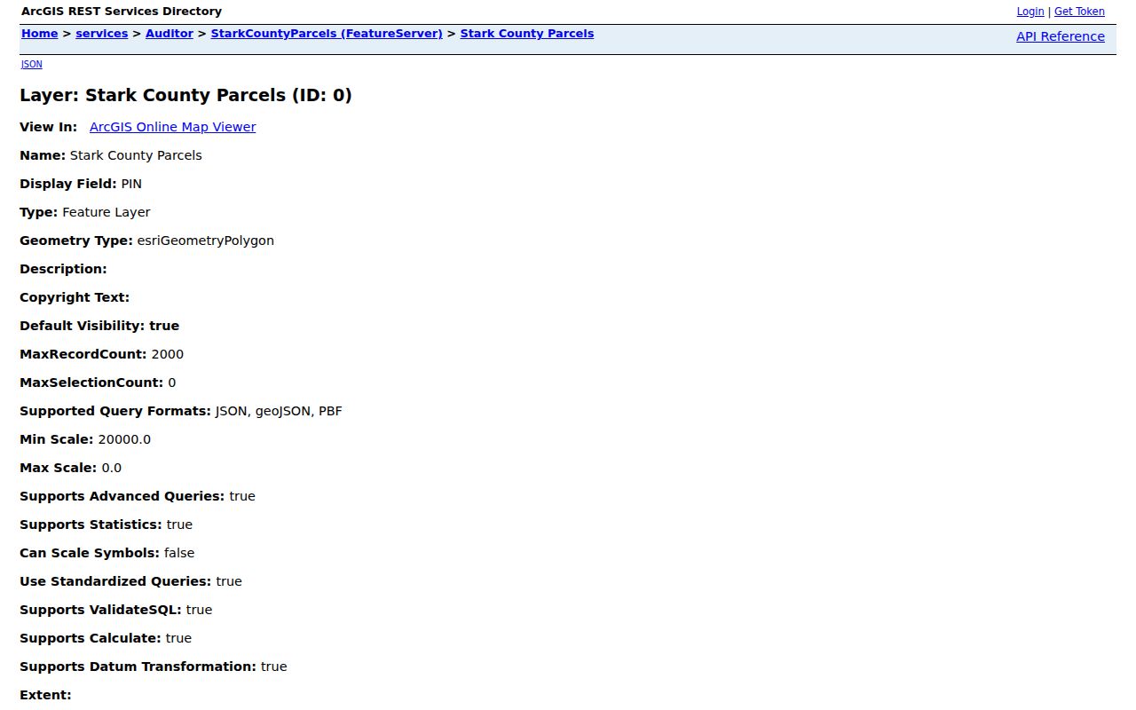
Use the service's owner and address fields as property-record facts, then check the recorded deed when title matters. Do not relabel a tax-card owner as a current occupant without independent, appropriate evidence.
Vacant lots, trusts, corporate ownership, and owners with outside mailing addresses are normal reasons that the public owner field and a person's physical presence do not match. That distinction is the central limit of an Alliance neighbors search.
Check Alliance Mahoning Parcel Records
Alliance addresses in Mahoning County need the Mahoning record chain from the first search. The Mahoning County Auditor supports parcel, owner, and address searches. Its instructions allow a single address, number range, or whole-street approach and permit partial owner-name searching. The parcel card distinguishes Deeded Owner Address, tied to the last recorded document, from Tax Payer Address, used for correspondence. Neither proves who occupies the site.
The Mahoning GIS and Tax Map route is shown below. It is the correct adjacent-parcel viewer after the county has been confirmed.
Mahoning's official GIS notice describes map boundaries as approximate and not a legal survey. Preserve that caution when comparing a map outline with a deed or a question about adjoining land.
Do not substitute a Stark search just because the address uses Alliance as its mailing city. The county custodian, parcel number, and recorded legal description control the route.
Limits on Alliance Block Voter Records
Ohio Voter Lookup is an individual confirmation tool, not a block-browse service. It requires a first name, last name, and county before it returns a result; a street-name selector appears only after a match. The public system may display permitted registration information for the named elector, but it does not offer a public command to list every voter on a street or around a parcel. Voting history records participation, never ballot choices.
For a historical or election-specific record question, Ohio law permits inspection and convenient precinct lists at a Board of Elections under defined rules, with protected records omitted. Public inspection can be paused around an election when it would interfere with election duties. The daily Ohio voter-data portal is a county-and-date request system, not an address-first neighborhood roster.
Safe at Home participant information is removed from public voter lists and the statewide database. State law also protects voter identification numbers, telephone and email information, and protected-address records. These are privacy safeguards, not gaps to work around.
Note: A named voter result can help confirm that person's own registration context, but it cannot establish every household member or create a block list.
Alliance Community Contact Sources
Research found public community contact layers, not an authoritative citywide neighborhood-association, HOA, or civic-club member directory. The 2025 Community Building Partnership reference identifies Maple Beach Neighborhood Association in Alliance's NE Quadrant and provides public leadership or community contact information. It is marked non-solicitation and is not a member directory. That makes it useful when seeking an appropriate public contact, not when trying to identify nearby households.
Maple Beach Neighborhood Association
Public community contact reference for Alliance's NE Quadrant.
Alliance Historical Society
Public local-history contact route, not a current resident directory.
330-736-1116
Alliance Community Gardens supply another public neighborhood anchor, with nine volunteer-run sites described by the city. Their locations can support a community or place-history question, but garden participation is not a published resident list. The same boundary applies to historical organizations, oral histories, and the civic, church, school, and association lists printed in old directories.
Alliance Block Record Differences
Official parcel and community sources answer different questions from commercial block-lookup categories. The official route identifies the custodian, scope, date, and legal limits of a record. Commercial results can combine old addresses or other data and may not explain the source date, correction path, or county boundary. Use the recorded-document or county source when a property fact needs confirmation.
| Source type | Useful for | Key limit |
|---|---|---|
| County parcel map and card | Adjacent lots, public owner fields, situs, and tax-map context. | Does not prove current household membership. |
| Recorder document | Recorded parties and the legal-description chain. | Does not create a current occupancy record. |
| Historic directory or Review | Published block context in a particular period. | Cannot establish a modern address or affiliation. |
| Commercial block-lookup tools | A possible lead to be checked independently. | May be dated, incomplete, or unclear about source and correction methods. |
Privacy Limits for Alliance Neighbors
Publicly available property information has clear edges. Renters, other household members, utility customers, delivery recipients, and protected residents are not made into a public block list by county map data. Ohio's Safe at Home program provides a substitute address for eligible people who fear for their safety, and participant information is removed from public voter lists. Court sealing and other record-specific restrictions still apply.
Lawful use. Alliance block research is for lawful personal, property, family, or community questions. Do not use public information to watch, intimidate, harass, or harm anyone.
Ohio's menacing-by-stalking and telecommunications-harassment laws prohibit harmful conduct, including conduct using electronic communications. If a parcel or community contact raises a safety concern, contact the appropriate public office through its published channel rather than confronting or tracking a person.